Historic Flooding
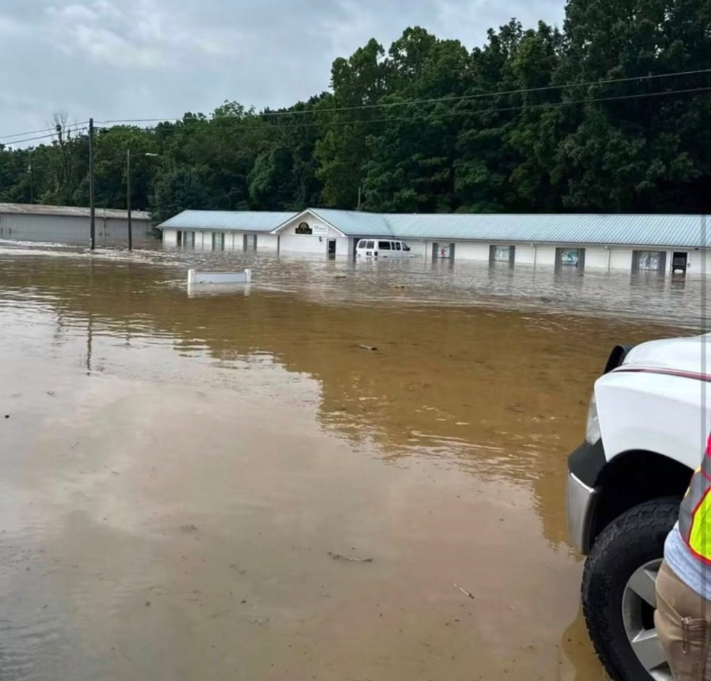
Alliance Counseling Associates located at 1007 West Stockton Street in Edmonton. Emergency personnel were station at both ends of the flood waters.
By PJ Martin
Editor, The Herald-News
Some areas of the county received up to 8 inches of heavy rainfall on June 26-27, causing major flooding in low-lying areas. Many were comparing it to the 100-year flood back in May 2010; however, the rain fell so quickly that flooding occurred in places not usually seen flooded.
West Stockton Street, entering Edmonton, was impassable as water covered the roadway and bridge. Water damaged many homes and businesses along the road, causing residents to save what they could before leaving their homes to the water’s mercy.
Water closed Hwy 496 (Red Barn), and not long after getting Hwy 640 back open from the continuous water that had blocked the road, it once again flooded. Many rural roads suffered damage, especially those with low water bridges and low-lying areas.
Police, fire, and rescue workers were called to duty everywhere to close roads and keep some residents from driving through the rushing water.
Metcalfe County Emergency Management Director Adam Bennett released the following statement: “Several homes and businesses were impacted. Most of them were in town, along West Stockton St. Initial damage assessment for those was completed on Monday, and we are hoping to hear back soon on whether or not those affected will qualify for FEMA assistance. The county road department and several residents worked quickly to get roads passable again, but permanent repair work will take a little longer.”
The governor declared a state of emergency on Saturday, June 27. As of Sunday, 18 local governments had also declared emergencies, including Bullitt, Clinton, Cumberland, Garrard, Grayson, Jackson, Jessamine, Madison, Meade, Mercer, Metcalfe, Spencer, and Wayne counties.
As of publication, the only road listed as closed in Metcalfe County per the KY Transportation Cabinet was KY 1048, closed at mile point 0.3.
The days following the flooding have brought temperatures and heavy humidity in the high 90s, causing the heat index to hit well over the 100-degree range. Making it all the more difficult as the clean-up gets underway.
The following photos were submitted by our readers.

Dunham Lake was overflowing down the side of the dam on Hwy 68.
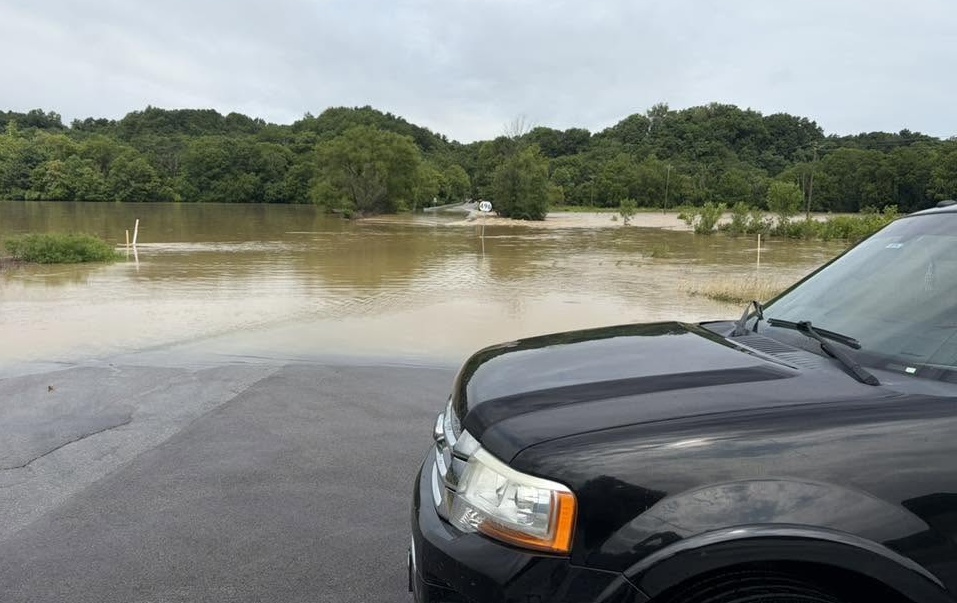
If you look closely, you can see the Hwy 496 road sign. Emergency personnel were stationed there.
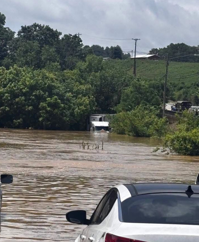
Have you ever wondered how strong flood waters can be? They were strong enough to float this parked semi and trailer backwards across the stockyard parking lot and into the creek. It was later pulled out.
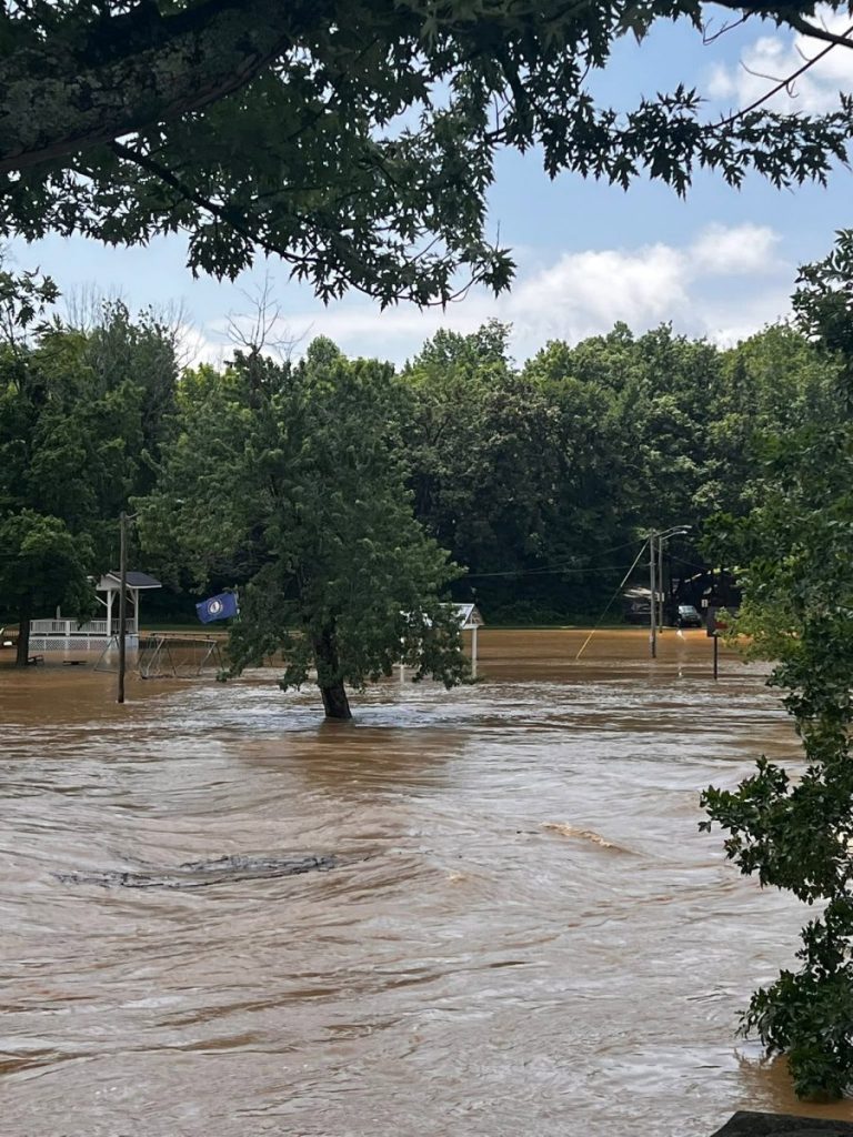
Sulphur Well Park was once again under water.
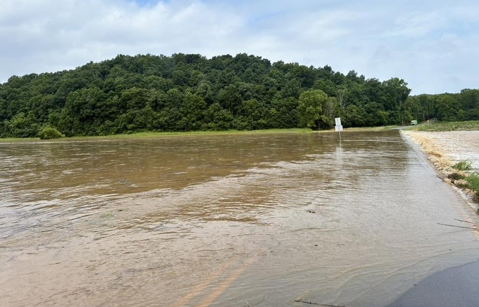
Breeding Road right before the Reece Hurt Road.